|
|||||||||||||||||||||||||||||||||||||||||||||||||||||||||||||||||||||||||||||||||||||||||||||||||||||||||||||||||||||||||||||||||||||||||||||||||||||
Saturday 13th June 2026 |
|||||||||||||||||||||||||||||||||||||||||||||||||||||||||||||||||||||||||||||||||||||||||||||||||||||||||||||||||||||||||||||||||||||||||||||||||||||
|
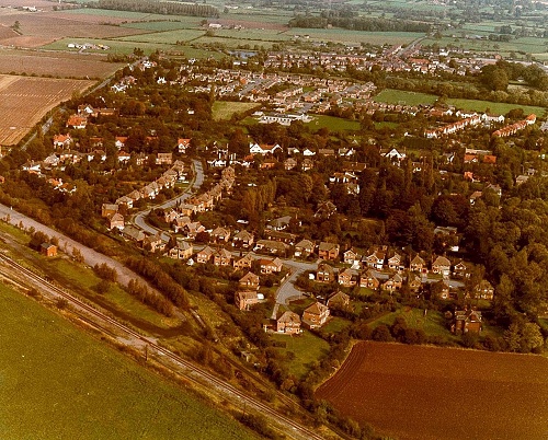
Aerial view of north west end of Quorn 1980s
Streets visible include Toller Road and Chestnut Close, plus the Great Central Railway in the foreground. Green areas that have since been developed include The Pingle and the old football ground, now Sutton Close. The Farley Way estate had not been build and the lake can be seen upper-centre.
|
|
|||||||||||||||||||||||||||||||||||||||||||||||||||||||||||||||||||||||||||||||||||||||||||||||||||||||||||||||||||||||||||||||||||||||||||||||||||